Central African Forest Biodiversity Assessment Tools - Complete Dashboard
Comprehensive Digital Toolkit for Conservation, Research, and Sustainable Management
Draft - 9 July 2025 - Stephan M Funk
Coverage Area: Cameroon • Central African Republic • Democratic Republic of Congo • Equatorial Guinea • Gabon • Republic of Congo
Over 25 specialised and general biodiversity assessment platforms cover Congo Basin forests. They cover a wide range of topics from cutting-edge satellite monitoring to community-based data collection. These tools address the unique challenges of Central African forests—high endemism, complex canopy structure, and limited ground access—through innovative approaches ranging from AI-powered species identification to real-time deforestation alerts. Most platforms are freely accessible and designed for collaborative use across the region's transboundary ecosystems.
The landscape of available tools reflects a coordinated international effort led by organisations like COMIFAC, CIFOR-ICRAF, and WCS, with substantial funding from the EU, USAID (now ceased), and other major donors. This comprehensive toolkit enables researchers and conservationists to conduct rigorous biodiversity assessments despite the logistical challenges of working in one of the world's most biodiverse but infrastructure-limited regions.
Central African forests benefit from an exceptionally comprehensive ecosystem of biodiversity assessment tools that address both the region's unique ecological characteristics and practical challenges. The combination of specialised regional platforms like OFAC and OSFAC with global databases like GBIF creates unprecedented opportunities for integrated biodiversity monitoring. The emphasis on open access, collaborative partnerships, and capacity building ensures that these tools remain accessible to local researchers and conservation practitioners. As AI-powered species identification and satellite monitoring capabilities continue to advance, Central African forest biodiversity assessment is poised to become increasingly sophisticated and effective, supporting evidence-based conservation in one of the world's most important biodiversity hotspots.
The Power of Unified Digital Workspaces: Why a Meta-Online-Tool Makes Sense for Central African Forest Biodiversity Assessment
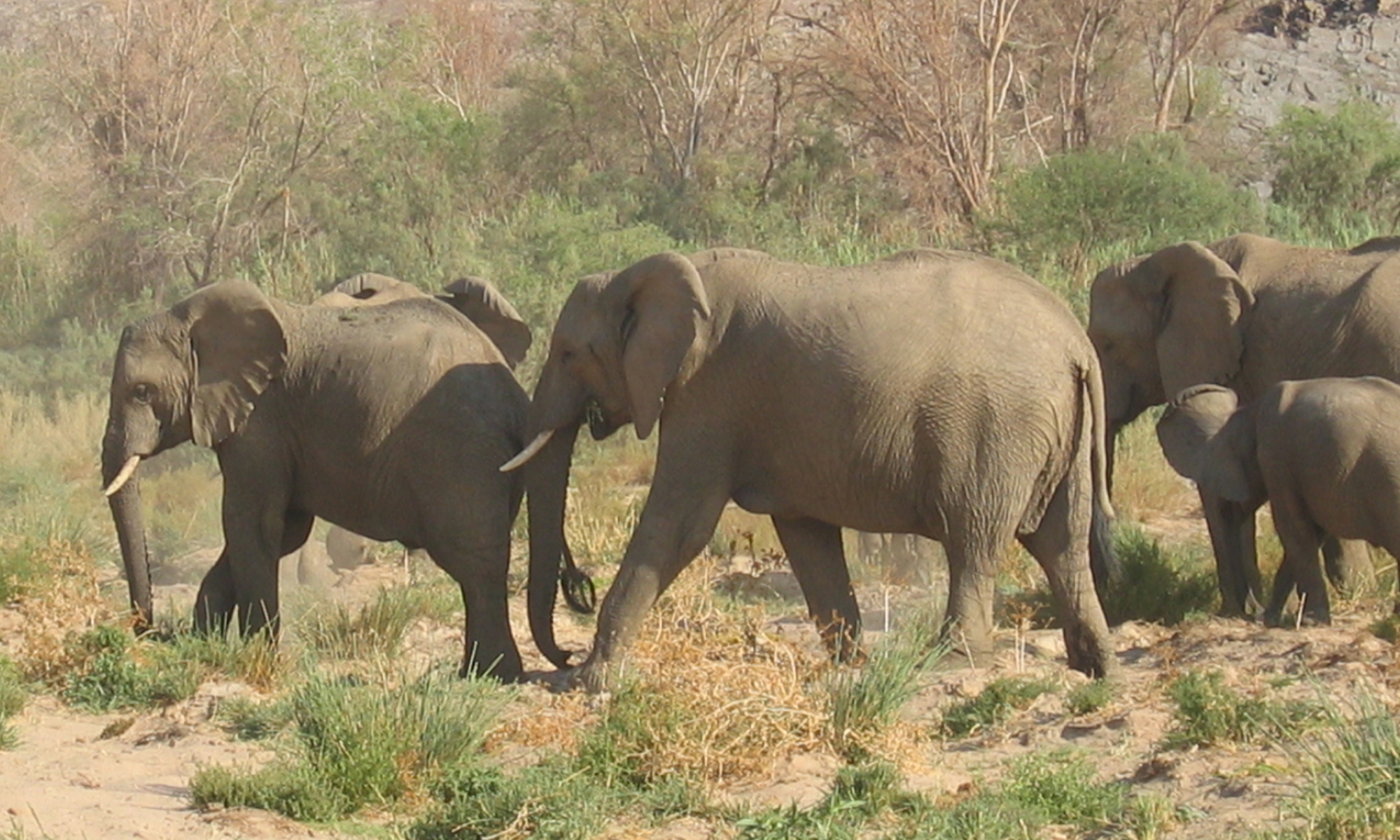
The forests of Central Africa represent 10% of the world's tropical forests and harbour species found nowhere else on Earth.
They deserve a 21st-century digital infrastructure that matches their global importance. Creating a unified Meta-Online-Tool for Central African forest biodiversity assessment isn't just a technological upgrade—it's a strategic imperative that could transform how we protect one of Earth's most critical ecosystems.
With over 25 specialised platforms currently in use, researchers and field teams waste countless hours navigating between tools, leading to data silos, missed insights, and delayed conservation actions.
A unified platform would deliver immediate ROI (Return on Investment) through enhanced efficiency, improved data quality, and accelerated conservation outcomes.
Creating a Meta-Online-Tool for Central African forest biodiversity assessment is not about building another platform—it's about multiplying the impact of every existing tool through intelligent integration.
The Meta-Tool Solution: One Portal, Infinite Possibilities
In a region where we're racing against time to document and protect biodiversity, we cannot afford the luxury of fragmented systems. A unified platform would:
- Transform ~25+ isolated tools into a powerful conservation ecosystem
- Reduce operational overhead, freeing resources for actual conservation
- Enable real-time, data-driven decisions that save forests and species
- Position Central African conservation at the forefront of digital innovation
The Current Challenge: Death by a Thousand Platforms
Biodiversity assessment teams currently juggle an overwhelming array of tools:
- OFAC for regional coordination
- GBIF for species occurrence data
- Global Forest Watch for deforestation alerts
- Wildlife Insights for camera trap analysis
- iNaturalist for species identification
- SMART for patrol management
- Google Earth Engine for satellite analysis
...and 18+ more specialised platforms
The unified Meta-Online-Tool would create a single access point that intelligently connects all biodiversity assessment platforms while preserving their specialised capabilities.
Emerging Methods for Biodiversity Assessments
Cutting-edge approaches transforming how we monitor Central African forest biodiversity
The landscape of biodiversity monitoring is rapidly evolving through five revolutionary technological approaches that are particularly transformative for tropical African ecosystems.
- • Camera traps equipped with AI-powered species identification algorithms are revolutionising wildlife monitoring by providing continuous, non-invasive surveillance that can automatically detect and classify species across vast forest areas, crucial for tracking elusive megafauna in the Congo Basin.
- • Audio monitoring systems deploy acoustic sensors that capture and analyze soundscapes to assess biodiversity through species vocalizations, offering unprecedented insights into nocturnal and cryptic species that traditional methods often miss in dense tropical forests.
- • Remote sensing technologies, enhanced by machine learning algorithms, enable real-time forest change detection and habitat mapping at unprecedented scales, allowing researchers to monitor deforestation, fragmentation, and ecosystem health across Central Africa's expansive landscapes.
- • Environmental DNA (eDNA) sampling represents a paradigm shift by detecting genetic material from water and soil samples, enabling scientists to identify entire communities of species—including rare and endangered taxa—without direct observation, particularly valuable in tropical Africa's biodiverse but often inaccessible aquatic ecosystems.
- • Finally, local ecological knowledge integration platforms are bridging traditional indigenous monitoring systems with modern technology, empowering local communities to contribute their invaluable long-term observations while strengthening community-based conservation efforts.
Together, these emerging tools are democratizing biodiversity assessment, making it more comprehensive, cost-effective, and culturally inclusive while addressing the urgent need for rapid, large-scale monitoring in one of Earth's most biodiverse and threatened regions.
Camera Traps
AI-powered wildlife monitoring with automated species identification
Environmental DNA
Revolutionary biodiversity detection through genetic material in water/soil
Audio Monitoring
Acoustic sensors for biodiversity assessment through soundscape analysis
Local Ecological Knowledge
Community-based monitoring integrating indigenous knowledge systems
Remote Sensing
Advanced satellite monitoring with AI-driven forest change detection
Digital Toolkits for Biodiversity Assessments
Comprehensive Biodiversity Assessment Toolkit
The modern landscape of biodiversity assessment in Central African forests is supported by an extensive ecosystem of digital tools spanning multiple technological domains and organisational scales. The toolkits encompass regional observatories that coordinate forest monitoring across national boundaries, global biodiversity databases containing billions of species occurrence records, wildlife monitoring platforms utilizing camera trap networks and patrol management systems, satellite monitoring services providing real-time forest change detection, AI-powered species identification tools revolutionizing field research, conservation assessment platforms for threat evaluation and planning, sophisticated data analysis environments for statistical modeling and spatial analysis, and partnership networks facilitating collaborative research and capacity building. These tools range from highly specialised platforms serving specific research communities to broadly accessible citizen science applications, collectively forming an interconnected web of resources that democratizes biodiversity monitoring while maintaining scientific rigour. The diversity of available platforms ensures that researchers, conservationists, local communities, and policymakers can access appropriate tools regardless of their technical expertise, budget constraints, or specific conservation objectives.
Most Frequently Used Platforms
Among these extensive toolkits, six platforms have emerged as the most widely adopted and essential resources for Central African biodiversity work. OFAC (Central African Forest Observatory) serves as the primary regional coordination hub, providing standardized forest monitoring data across all member countries. GBIF offers unparalleled access to global biodiversity data with over 2.6 billion occurrence records, making it indispensable for species distribution analysis. iNaturalist has transformed community engagement through citizen science, accumulating over 230 million observations worldwide with growing coverage in Central Africa. Global Forest Watch provides the most accessible real-time forest monitoring platform, combining government data with satellite alerts for comprehensive deforestation tracking. CARPE Mapper focuses specifically on 12 priority landscapes across the Congo Basin, offering detailed regional analysis capabilities, while OSFAC maintains Central Africa's most comprehensive satellite imagery archive with over 35,000 images. These six platforms form the backbone of most biodiversity assessment projects in the region, offering free core functionalities that ensure essential monitoring capabilities remain accessible to all conservation stakeholders regardless of resource limitations.
FAC • GBIF • iNaturalist • Global Forest Watch • CARPE Mapper • OSFAC
Regional Observatories
Primary coordination hubs for Central African forest monitoring
- The Central African Forest Observatory (OFAC), operated by COMIFAC (Central African Forests Commission, Commission des Forêts d'Afrique Centrale), serves as the primary coordination hub for forest biodiversity data across all 10 member countries. This platform provides biennial "State of the Forest" reports since 2005 and maintains an interactive data platform combining satellite imagery with ground-based observations. OFAC's strength lies in its regional coordination role, standardising monitoring approaches across transboundary ecosystems and providing policy-relevant indicators for forest management decisions.
- OSFAC (Observatoire Satellital des Forêts d'Afrique Centrale) complements OFAC by serving as Central Africa's only satellite data clearing house. Based in Kinshasa, OSFAC maintains a database of over 35,000 Landsat images spanning 1972-2014 and provides automated forest change detection capabilities. This platform addresses the unique challenge of cloud cover in Central African forests through specialised satellite analysis techniques designed for tropical environments.
- The CARPE Mapper (Central Africa Regional Program for the Environment ) platform, developed by the University of Maryland with NASA support, focuses on 12 priority landscapes across the Congo Basin. It is a USAID-led initiative launched in the late 1990s to promote sustainable natural resource management in the Congo Basin, but the future is now uncertain due to the cessation of funding for USAID. This tool provides real-time forest cover monitoring using multiple satellite sensors and integrates with REDD+ monitoring systems, making it particularly valuable for carbon inventory and international reporting requirements.
Conservation Assessment
Threat evaluation and conservation planning tools
- The IUCN Red List of Threatened Species maintains comprehensive threat assessments for Central African forest species, with regular updates every 5-10 years. The platform's Green Status assessments provide forward-looking conservation impact measurements, while the Red List of Ecosystems offers a systematic assessment of forest ecosystem collapse risk.
- IBAT (Integrated Biodiversity Assessment Tool) provides subscription-based access to biodiversity risk screening for development projects, combining species occurrence data with threat assessments and protected area boundaries. This platform is particularly valuable for environmental impact assessments and corporate sustainability reporting.
- TRAFFIC's AFRICA-TWIX platform connects nine countries in wildlife trade monitoring, maintaining over 720,000 records in its wildlife trade database. This system is crucial for understanding illegal wildlife trade impacts on Central African forest biodiversity.
Data Analysis Tools
Sophisticated analysis and modelling platforms
- The R programming environment provides the most comprehensive toolkit for biodiversity analysis, with specialized packages like vegan for community ecology analysis, dismo for species distribution modelling, and rgbif for direct GBIF data access. Over 1,000 spatial analysis packages are available, making R the platform of choice for sophisticated biodiversity research.
- Species distribution modelling platforms like MaxEnt and Biomod2 integrate directly with biodiversity databases and climate datasets, enabling researchers to model species distributions and predict climate change impacts on Central African forest biodiversity.
Global Biodiversity Databases
Comprehensive species occurrence and distribution data
- GBIF (Global Biodiversity Information Facility) provides the most comprehensive species occurrence database, with over 2.6 billion records globally and extensive coverage of Central African biodiversity. The platform's strength lies in its standardized data formats and integration with research tools, enabling large-scale biogeographical analyses. GBIF's BID (Biodiversity Information for Development) program specifically targets sub-Saharan Africa with capacity building and data mobilization initiatives.
- iNaturalist has emerged as a powerful citizen science platform with over 230 million observations worldwide and growing engagement in Central Africa. The platform's AI-powered species identification capabilities work particularly well for forest biodiversity documentation, while its community-based verification system ensures data quality. Research-grade observations from iNaturalist automatically feed into GBIF, creating a seamless data pipeline from field observations to global databases.
- The RAINBIO database deserves special mention as it contains 609,776 georeferenced records of tropical African vascular plants, providing the most comprehensive botanical dataset for Central African forests. This database covers 25,356 species, with 97% having growth form data, making it invaluable for ecological modelling and conservation planning.
Species Identification
AI-powered and taxonomic identification tools
- Pl@ntNet provides AI-powered plant identification specifically tailored for Central African flora through its "Tropical Africa" and "West-Central Tropical Africa" modules. This platform combines community validation with machine learning to support field identification of forest plants, while contributing observations to global botanical databases.
- The Digital Flora of Central Africa offers comprehensive taxonomic information specifically designed for the region's plant diversity. This platform provides species descriptions, distribution maps, and botanical illustrations that are essential for taxonomic research and conservation planning.
- Wildlife Insights and similar AI-powered platforms are revolutionising camera trap data analysis, enabling automated species identification and behaviour analysis from the millions of images collected across Central African forests.
Partnerships & Training
Collaborative initiatives and capacity building programs
- Most platforms follow open access models with free registration and data sharing (except IBAT). OFAC, GBIF, Global Forest Watch, and iNaturalist provide completely free access to their core functionalities, while platforms like IBAT offer subscription-based premium services for commercial users.
- Training and capacity building programs are integral to most platforms. CIFOR-ICRAF's RESSAC Programme provides applied research training, while GBIF's BID program offers specific capacity building for sub-Saharan African researchers. WCS provides technical support for SMART implementation, and COMIFAC coordinates regional training initiatives.
- Collaborative partnerships enable access to specialised tools and datasets. The Congo Basin Forest Partnership (CBFP) coordinates multi-stakeholder collaboration, while CAFI (Central African Forest Initiative) provides over €6 billion in funding for transformational forest research and conservation.
Wildlife Monitoring
Camera trap networks and patrol management systems
- The TEAM Network (Tropical Ecology Assessment and Monitoring) provides standardised protocols for camera trap monitoring across multiple Central African sites. With over 3 million camera trap images collected, this network enables population trend monitoring and early warning system development for forest mammals and birds.
- SMART (Spatial Monitoring and Reporting Tool), developed by WCS and partners, focuses on law enforcement and anti-poaching patrol management. This platform has been deployed across major Central African parks, including Odzala-Kokoua, Nouabalé-Ndoki, and Dzanga-Sangha, providing standardised wildlife monitoring and threat assessment capabilities.
- eBird offers comprehensive bird monitoring capabilities with over 500 million records globally and growing coverage in Central Africa. The platform's semi-structured protocols enable both citizen science participation and research-grade data collection, while its real-time data feeds support conservation decision-making.
Satellite Monitoring
Real-time forest change detection and habitat mapping
- Global Forest Watch provides the most accessible platform for real-time forest monitoring, with specialised Forest Atlases for all six Congo Basin countries that combine government data with satellite alerts. The platform's GLAD and RADD deforestation alert systems provide near real-time monitoring of forest disturbance, while the Forest Watcher mobile app enables offline data collection in remote areas.
- Google Earth Engine offers the most powerful computational platform for large-scale biodiversity habitat mapping, providing access to petabyte-scale satellite imagery and machine learning algorithms. This platform is particularly valuable for researchers conducting landscape-level analyses of forest connectivity and habitat fragmentation patterns.
- NASA Earth Data Systems complement these platforms with specialized forest monitoring products, including the GFCC (Global Forest Cover Change) datasets at 30-meter resolution and the INFORMS (Integrated Forest Monitoring System) specifically designed for Central Africa.
Conservation NGOs Working in Central African Forests
Major international and regional conservation organisations implementing on-the-ground applied conservation and, some of them, applied research programs across the Congo Basin
Note: These organisations work in partnership with local communities, governments, and each other through initiatives like the Congo Basin Forest Partnership (CBFP), which brings together some 70 partners including African countries, donor agencies, international organisations, NGOs, scientific institutions and the private sector.